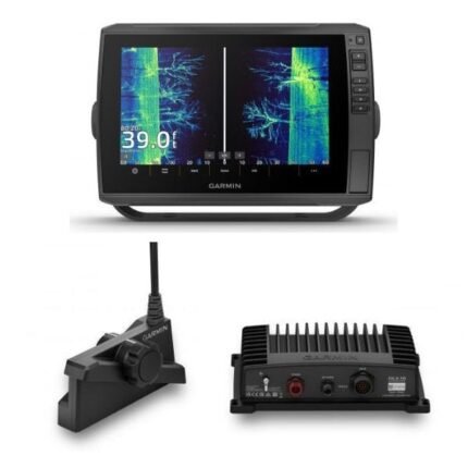

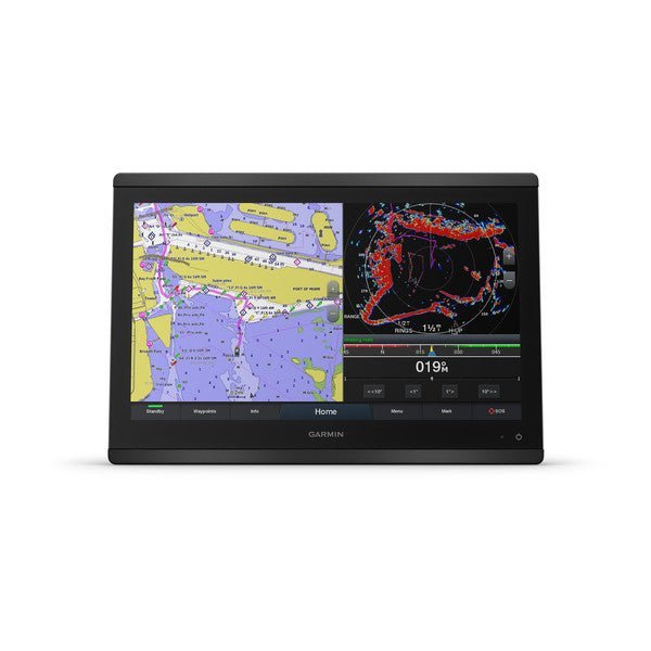
Garmin GPSMAP® 8616 Chartplotter
Original price was: $5,699.99.$4,274.99Current price is: $4,274.99.
Apple Pay
G Pay
Mastercard
PayPal
VISA
✓
Shipping from Chicago
Usually ready after payment
↺
30-Day Free Returns
Free return or refund within 30 days
🚚
Order within 1 to 24h
Shipping typically takes 1–3 business days
Garmin GPSMAP8616 16″” Plotter Garmin Navionics+ coastal and inland water charts for the U.S. and Canada
Model: 010-02093-50
- Features a 16″ full HD in-plane switching touchscreen display for wider viewing angles, superior clarity and sunlight readability, even with polarized sunglasses
- Adds a stunning appearance with ability to install multiple displays either flat mounted edge- to-edge to create a sleek glass helm look or mounted flush
- Fully network capable with NMEA 2000® connectivity and the Garmin Marine Network to easily build your marine system — from sonar, radar and autopilots to instruments, cameras and multimedia
- ANT® connectivity and Wi-Fi® networking let you connect with your compatible quatix® smartwatches, gWind™ Wireless 2 wind sensor and more
- For full control of your boat on your chartplotter screen, use our exclusive OneHelm™ feature to connect to many third-party devices
- See RPMs, fuel flow, temperature, trim and more for up to four of your compatible Mercury® engines by using the SmartCraft® Connect gateway
- Preloaded Garmin Navionics+™ coastal charts and inland mapping feature Auto Guidance+™ technology (Auto Guidance+ is for planning purposes only and does not replace safe navigation operations) ; plus, there’s support for optional Garmin Navionics Vision+™ premium map content.
- Compatible with the live sonar PS51 transducer with FrontVü™ forward-looking sonar, which helps you avoid running aground
- SmartMode™ station controls enable presets for one-touch access to docking, cruising, fishing, anchoring and more
- Built-in Garmin SailAssist™ features provide data, displays and prerace guidance needed to gain a competitive edge
- Use built-in Wi-Fi® networking to pair with the free ActiveCaptain® smartphone app for access to the OneChart™ feature, smart notifications, Garmin Quickdraw™ Community data and more.
- Dual microSD™ card slots on back of unit for use with the ActiveCaptain® app and cartography cards
The GPSMAP®8616 chartplotter features a 16″ full HD in-plane switching touchscreen display for wider viewing angles, superior clarity and sunlight readability, even with polarized sunglasses. Experience superior connectivity and networking solutions with complete control of your entire system, right at your fingertips. The device is preloaded with Garmin Navionics+™coastal charts and inland mapping that feature Auto Guidance+™technology (Auto Guidance+ is for planning purposes only and does not replace safe navigation operations). Plus, there’s support for optional Garmin Navionics Vision+™premium map content. The chartplotter includes a premium-performance processor for our fastest map drawing, superior networking, video distribution and more. Multiple displays can be flat mounted edge-to-edge to create a sleek glass helm look or mounted flush. NMEA 2000®networking and the Garmin Marine Network allow you to build your full marine electronics suite — from radar and autopilots to cameras and instruments — controlled from your chartplotter and shared across multiple screens. With SmartMode™station controls, everything is designed to give you quick, one-touch access to the information you need to ease high-stress situations such as docking. For full control of your boat on your chartplotter screen, use our exclusive OneHelm™feature to connect to many compatible third-party devices. Built-in Garmin SailAssist™features provide data, displays and prerace guidance needed to gain a competitive edge. Download the ActiveCaptain® smartphone app to your smartphone or tablet to manage your marine experience from anywhere — from trip planning and prefishing to purchasing, downloading and updating maps. See RPMs, fuel flow, temperature, trim and more for up to four of your compatible Mercury®engines by using the SmartCraft®Connect gateway.
Specifications
| General | |
| Physical dimensions | 15.1″” x 10.3″” x 3″” (38.5 cm x 26.3 cm x 7.6 cm) |
| Weight | 9.6 lbs (4.4 kg) |
| Water rating | IPX6 and IPX7 |
| Display type | touchscreen IPS display (anti-glare finish) |
| Display size | 13.6″” x 7.7″” (34.5 cm x 19.5 cm) |
| Display resolution | FHD; 1920 x 1080 pixels |
| Power consumption | 3.5 A |
| Antenna | Internal or external over NMEA 2000 |
| Mounting options | Flat and flush, bail with optional accessory (Garmin does not offer any hardware or accessories for a flat-mount installation. Professional tools and knowledge is required.) |
| Receiver | 10 Hz GPS/GLONASS/Galileo |
| Garmin Marine Network™ ports | 2 |
| Maps & Memory | |
| Accepts data cards | 2 microSD cards (on back) |
| Waypoints | 5,000 |
| Routes | 100 (250 waypoints each) |
| Track log | 50,000 points; 50 saved tracks |
| pre-loaded maps | Garmin Navionics+ coastal and inland water charts for the U.S. and Canada |
| Outdoor Recreation Features | |
| Tide tables | Yes |
| Chartplotter Features | |
| Garmin Radar compatible | Yes |
| Garmin Sonar compatible | Yes |
| Garmin SmartMode compatible (customizable monitor presets) | Yes |
| Supports AIS (tracks target ships position) | Yes |
| Supports DSC (displays position data from DSC-capable VHF radio) | Yes |
| Supports FUSION-Link™ compatible radios | Yes |
| GSD™ Black Box sonar support | Yes |
| GCV™ Black Box sonar support | Yes |
| ActiveCaptain compatible | Yes |
| Garmin Helm compatible | Yes |
| GRID™ (Garmin Remote Input Device) compatible | Yes |
| Wireless remote compatible | Yes |
| Sonar Features & Specifications | |
| Dual-frequency (50/200 kHz) sonar capable | Yes (with external black box, sold separately) |
| Dual-beam (77/200 kHz) sonar capable | Yes (with external black box, sold separately) |
| Frequencies supported | NA |
| Transmit power | NA |
| CHIRP sonar technology | Yes_(when_connected_to_another_compatible_sonar_device) |
| ClearVü | yes (with GCV™ black box, sold separately) |
| SideVü | yes (with GCV™ black box, sold separately) |
| Maximum depth | NA |
| Connections | |
| NMEA 2000® compatible | Yes |
| Transducer pin numbers | na |
| NMEA 0183 input ports | 1 differential |
| NMEA 0183 output ports | 1 differential |
| Video input ports | 1 – BNC composite 1 – HDMI (HDCP compliant) |
| Video output ports | 1 HDMI |
| Wireless connectivity | Yes |
What’s in the Box:
- GPSMAP 8616 Garmin Navionics+ coastal and inland water charts for the U.S. and Canada
- Power cable
- NMEA 2000® drop cable
- NMEA 2000 T-connector
- Documentation
- Flush mount kit
- Sun cover
- Trim piece snap covers